ENRR
El Niño Rapid Response Field Campaign
Current Conditions
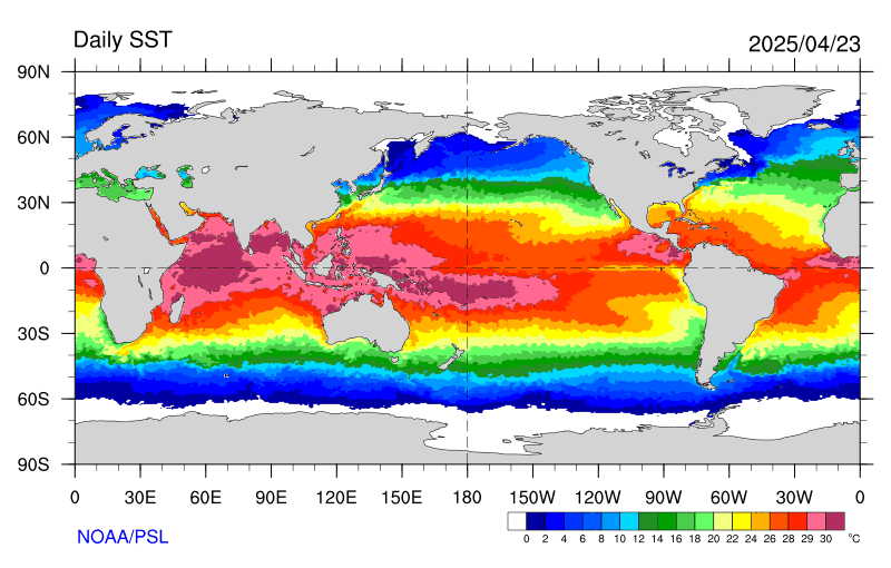
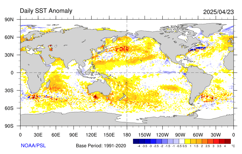
Sea Surface Temperature (SST)
More SST Maps (PSL Map Room): Weekly, Monthly, and Seasonal Averages
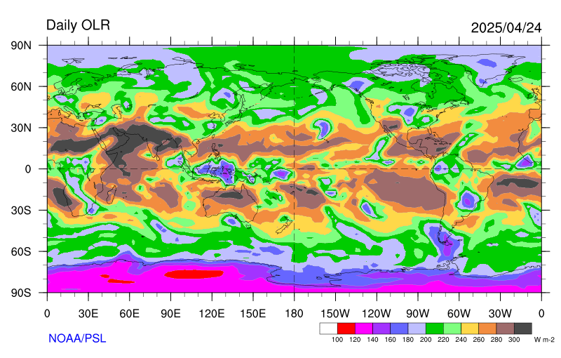
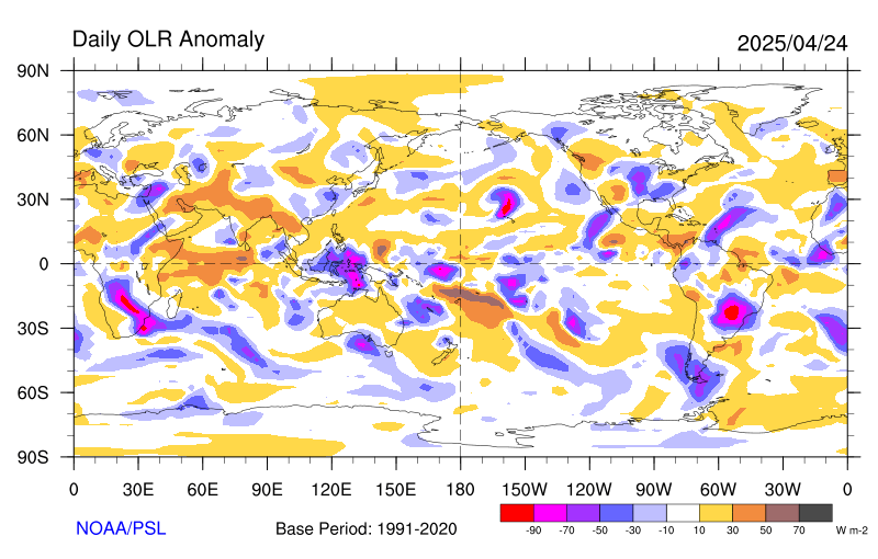
Outgoing Longwave Radiation (OLR)
More OLR Maps (PSL Map Room): Weekly, Monthly, and Seasonal Averages
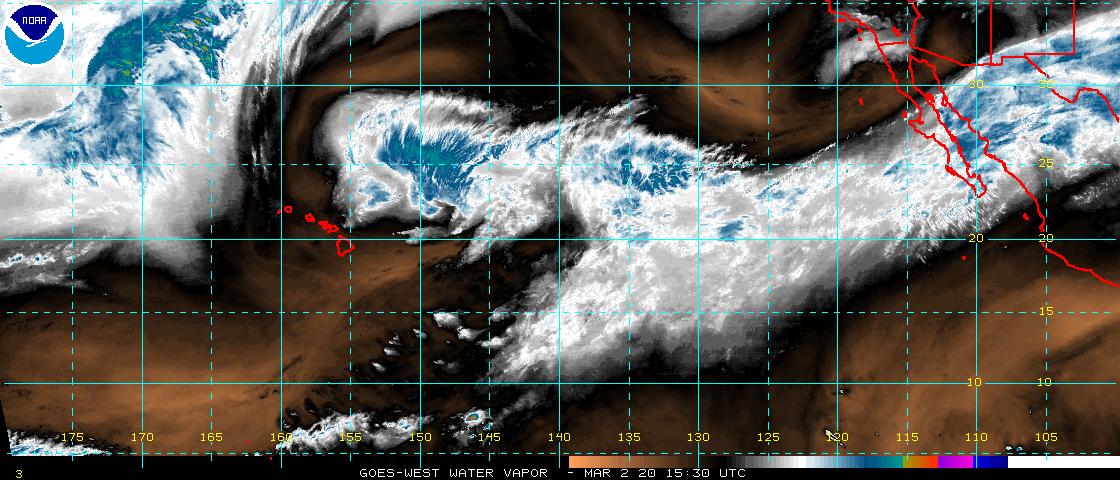
Satellite Imagery (NOAA)

More NOAA Satellite Images: Other Sectors
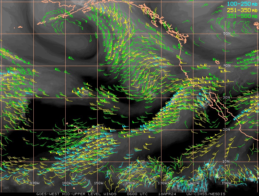
Satellite Imagery (UW-SSEC)


More SSEC Satellite Images: Full Disk Channel Comparison
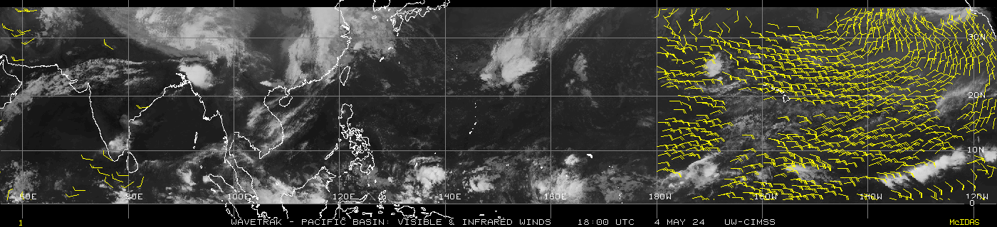
CIMSS Global Products
More Plots: Selectable Maps for the globe
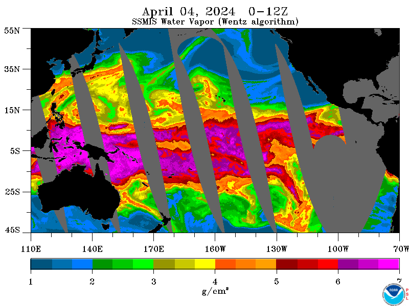
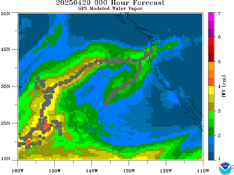
Integrated Water Vapor (NOAA/ESRL/PSL)
PSL SSMI/SSMIS IWV
GFS 24-hour IWV Forecast
More PSL IWV Products: Analyses, Forecasts, Satellite Products
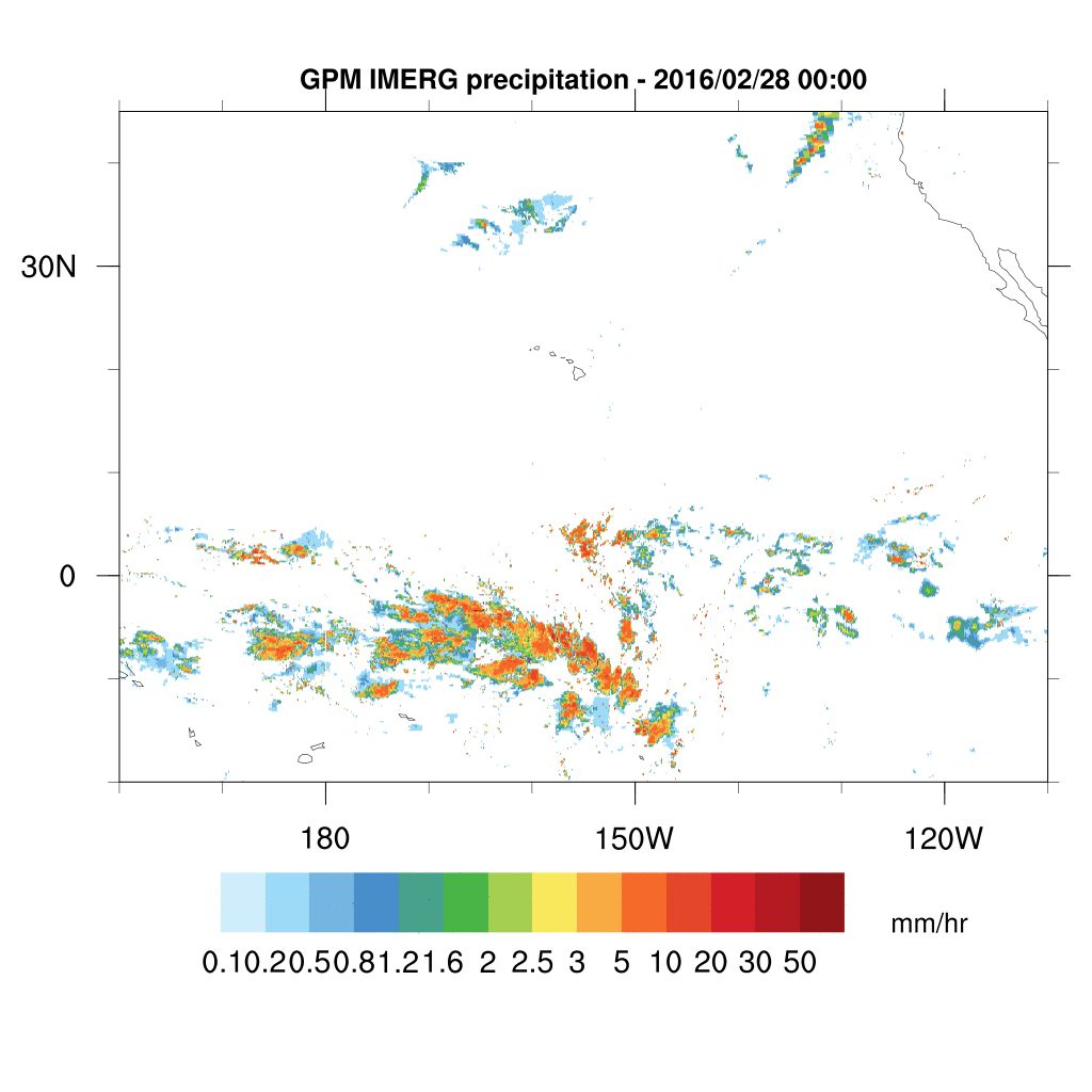
Precipitation


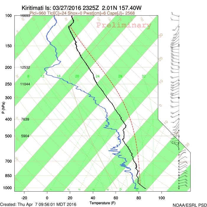
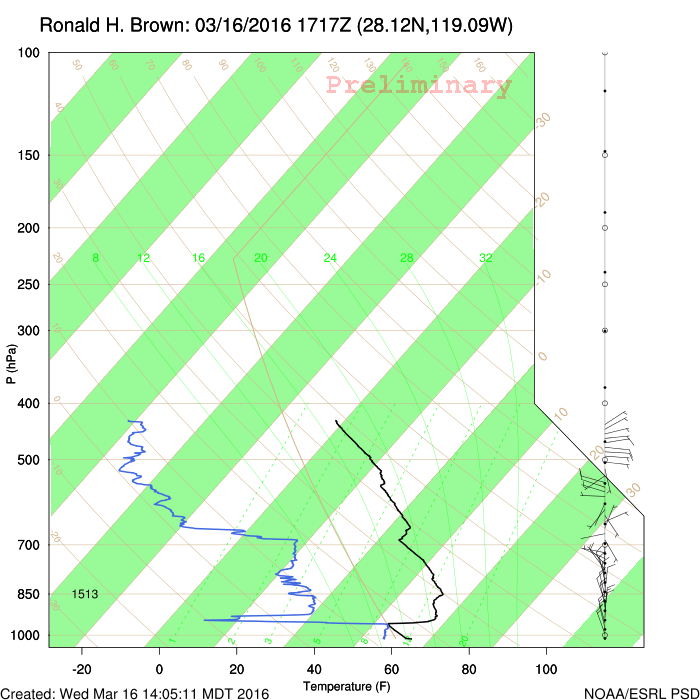
Soundings
Tropical Forecast Resources
Related Links
MJO Plots
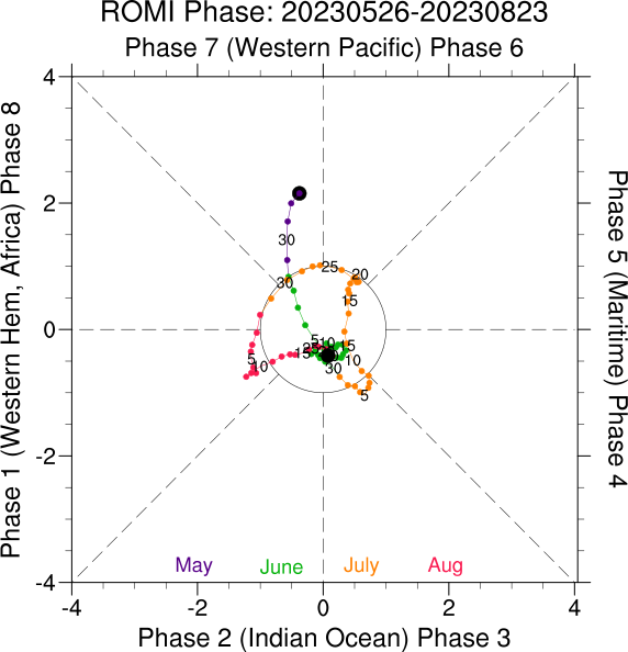
ROMI Phase Diagram - Last 90 Days
MJO 30-Day Forecast

Short-Term Forecast Resources
Images

Other Short-Term Forecast Products
Medium Range Forecast Resources
Model Comparisons

PSL Experimental GEFS Comparisons
PSL is running Version 10 of the Global Ensemble Forecast System (GEFS) (not the NCEP Operational GEFS (version 11)) in an experimental mode comparing observed and climatological SSTs. The maps below compare the two runs for weekly averages. NOTE: Skill statistics of this PSL version of the GEFS model are not to be used as a proxy for the skill of the NCEP operational model.
Model Run: 00Z
Comparison Maps - Analyzed SST minus Climo SST
| Days 0-7 | Days 8-14 |
|---|---|
| Days 15-22 | Days 23-30 |
Additional Resources
Kirabati Met Service Links
NOAA Pacific Region Products
- NWS/Honolulu
- NWS/Pacific Region HQ
- Pacific Obs
- Central Pacific Hurricane Center
- Pacific Analyses/Forecasts