SPLASH
Study of Precipitation, the Lower Atmosphere and Surface for Hydrometeorology
About
News
April 1, 2026 • Serendipity Leads to the SAIL-SPLASH-SOS Special Collection - AMS HeadlinesBenefits
In combination with scientific analysis of the resulting datasets, research will apply SPLASH observations and the resulting enhanced process-understanding to evaluate and improve NOAA's latest suite of modeling tools, including the Unified Forecast System, Rapid Refresh Forecast System, and National Water Model. The ultimate goal of this project will be improved prediction of weather and water in the Colorado mountains and beyond to inform societal preparedness and response.
Partners
- NOAA: Physical Sciences Laboratory; National Severe Storms Laboratory; Global Systems Laboratory; Global Monitoring Laboratory; Air Resources Laboratory; NWS Office of Water Prediction, National Water Center; Atmospheric Science for Renewable Energy Program
- University of Colorado, Boulder: Cooperative Institute for Research in Environmental Sciences; Integrated Remote and In Situ Sensing
- Colorado State University, Ft. Collins: Cooperative Institute for Research in Atmospheric Science; Electrical and Computer Engineering Dept.
- Black Swift Technologies - Boulder, CO
- National Center for Atmospheric Research - Boulder, CO
- US Department of Energy, Lawrence Berkeley National Laboratory - Berkeley, CA
- Rocky Mountain Biological Laboratory - Gothic, CO
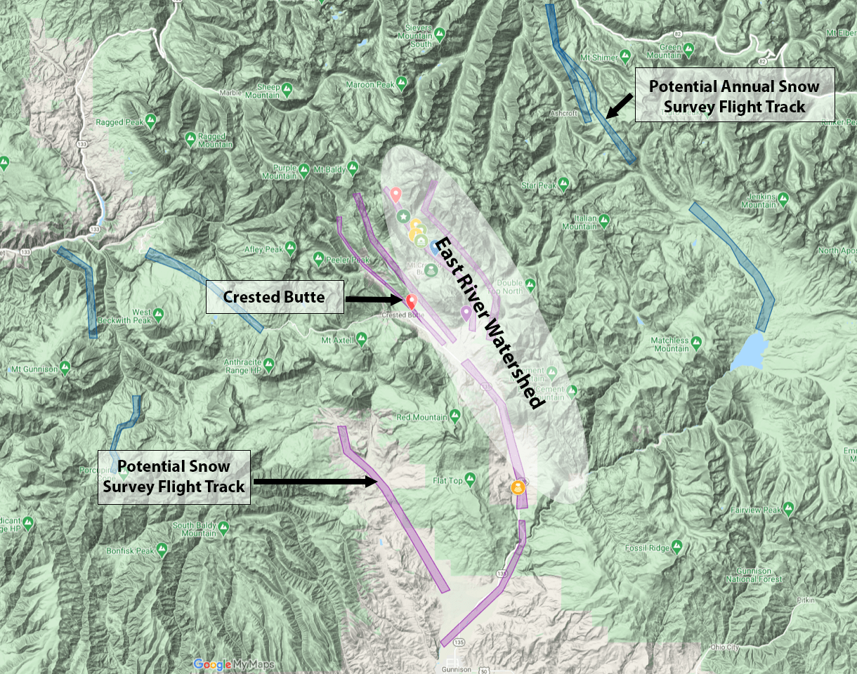
Figure. Topographic image of the Crested Butte–Gunnison region, showing the location of SPLASH surface instrumentation (colored icons) and potential NOAA snow survey flight tracks (purple). Together, the SPLASH network and airborne snow survey measurements provide a unique set of observations that can inform seasonal water supply and flood risk outlook.
SPLASH Data
Data Links and Archived Plots
Data Comparisons
Historical Radar Data Viewer
Dataset references and DOIs
See recent additions and more information on the Zenodo Community SPLASH site.- Adler, Bianca; Bianco, Laura; Djalalova, Irina; Myers, Timothy; Wilczak, James; Ballard, Brad (2025). SPLASH Field Study; NOAA PSL thermodynamic profiles retrieved from ASSIST infrared radiances with the optimal estimation physical retrieval TROPoe (NCEI Accession 0303808). NOAA NCEI. Dataset. https://doi.org/10.25921/wcbz-8383
- Adler, Bianca; Bianco, Laura; Djalalova, Irina; Myers, Timothy; Pezoa, Sergio; Bariteau, Ludovic; Wilczak, James; Ballard, Brad (2025). SPLASH Field Study; NOAA PSL CL31 Ceilometer Backscatter and Cloud Base Height Data from 2021-10-21 to 2022-01-28 (NCEI Accession 0303807). NOAA NCEI. Dataset. https://doi.org/10.25921/6hnc-rh58
- Adler, Bianca; Smith, Elizabeth; Bell, Tyler; Gebauer, Joshua; Ballard, Brad (2025). SPLASH Field Study; NOAA NSSL CLAMPS2 TROPoe Retrievals from 2021-10-21 to 2022-01-18 (NCEI Accession 0303080). NOAA NCEI. Dataset. https://doi.org/10.25921/9nsn-0p81
- Cox, Christopher; Gallagher, Michael; Intrieri, Janet; Butterworth, Brian; Meyers, Tilden; Persson, Ola; Ballard, Brad (2025). SPLASH Field Study; Atmospheric Surface Flux Station #50 measurements (level 2 Processed), Oct2021-Jun2023 (NCEI Accession 0303960). NOAA NCEI. Dataset. https://doi.org/10.25921/j9hx-mt86
- Cox, Christopher; Gallagher, Michael; Intrieri, Janet; Butterworth, Brian; Meyers, Tilden; Persson, Ola; Ballard, Brad (2025). SPLASH Field Study; Atmospheric Surface Flux Station #30 measurements (level 2 Processed), Sep2021-Jul2023 (NCEI Accession 0303959). NOAA NCEI. Dataset. https://doi.org/10.25921/2q0f-j097
- Cox, Christopher; Intrieri, Janet; Shupe, Matthew; Schmatz, Benjamin; Ballard, Brad (2025). SPLASH Field Study; Continuous snow temperature profiles from the Snow Ice Mass Balance Apparatus (SIMBA) level 1 Raw, Nov2022-Jun2023 (NCEI Accession 0304095). NOAA NCEI. Dataset. https://doi.org/10.25921/9d7a-hg03
- Elston, Jack; Jackson, Darren; Stachura, Maciej; de Boer, Gijs; Intrieri, Janet; Dai, Eryan; Ballard, Brad (2025). SPLASH Field Study; BST/NOAA PSL Level 3 UAS Soil Moisture, Digital Elevation, Normalized Difference Vegetative Index, and Surface Temperature (NCEI Accession 0301536). NOAA NCEI. Dataset. https://doi.org/10.25921/kre7-sn43
- Intrieri, Janet; Jackson, Darren; de Boer, Gijs; Longenecker, John; Stachura, Maciej; Currier, William R.; Ballard, Brad (2025). SPLASH Field Study; NOAA PSL Soil Moisture and Surface Temperature Probe Data at Avery Picnic and Kettle Ponds, Colorado (NCEI Accession 0302136). NOAA NCEI. Dataset. https://doi.org/10.25921/9875-sa56
- Intrieri, Janet; de Boer, Gijs; Hamilton, Jonathan; Calmer, Radiance; Ballard, Brad (2025). SPLASH Field Study; HELiX UAS Solar Irradiance data from 2022-03-12 to 2022-06-04 (NCEI Accession 0303584). NOAA NCEI. Dataset. https://doi.org/10.25921/1x3z-k658
- Meyers, Tilden; Ballard, Brad (2025). SPLASH Field Study; Brush Creek Flux Data for Publication (NCEI Accession 0305465). NOAA NCEI. Dataset. https://doi.org/10.25921/bet4-h976
- Smith, Elizabeth; Bell, Tyler; Bunting, Lydia; Ballard, Brad (2025). SPLASH Field Study; CLAMPS2 Doppler Lidar VAD Data (NCEI Accession 0304717). NOAA NCEI. Dataset. https://doi.org/10.25921/rpx2-t532
- Smith, Elizabeth; Bell, Tyler; Bunting, Lydia; Ballard, Brad (2025). SPLASH Field Study; CLAMPS2 Doppler Lidar Vertical Stare Data (NCEI Accession 0304847). NOAA NCEI. Dataset. https://doi.org/10.25921/0jsk-jt23
- Soldo, Logan; Stierle, Scott; Hall, Emiel; Herrera, Christian; Hodges, Gary; Ballard, Brad (2025). SPLASH Field Study; NOAA GML Brush Creek & Kettle Ponds Snow Depth Estimates (NCEI Accession 0302850). NOAA NCEI. Dataset. https://doi.org/10.25921/ywdd-4314
- Soldo, Logan; Stierle, Scott; Hageman, Derek; Hall, Emiel; Herrera, Christian; Hodges, Gary; Lantz, Kathy; Riihimaki, Laura; Sedlar, Joseph; Ballard, Brad (2025). SPLASH Field Study; NOAA GML Surface Radiation Budget and Near-Surface Meteorology Data at Kettle Ponds and Brush Creek, Colorado (NCEI Accession 0302673). NOAA NCEI. Dataset. https://doi.org/10.25921/125x-nz30
- Telg, Hagen; Sedlar, Joseph; Herrera, Christian; Stierle, Scott; Ballard, Brad (2025). SPLASH Field Study; NOAA and CIRES Ceilometer Cloud Data Products at Kettle Ponds, Colorado, 2021-10-19 to 2023-08-15 (NCEI Accession 0301002). NOAA NCEI. Dataset. https://doi.org/10.25921/5ajc-sm08
- Telg, Hagen; Sedlar, Joseph; Herrera, Christian; Stierle, Scott; Ballard, Brad (2025). SPLASH Field Study; NOAA and CIRES Ceilometer Cloud Data Products at Brush Creek, Colorado, 2021-10-19 to 2023-08-14 (NCEI Accession 0301003). NOAA NCEI. Dataset. https://doi.org/10.25921/v28k-r512
- Telg, Hagen; Sedlar, Joseph; Riihimaki, Laura; Soldo, Logan; Stierle, Scott; Hall, Emiel; Hodges, Gary; Lantz, Kathleen; Ballard, Brad (2025). SPLASH Field Study; Spectral Surface Albedo Observations from NOAA GML/GRAD and CIRES at Kettle Ponds (CKP) (NCEI Accession 0305473). NOAA NCEI. Dataset. https://doi.org/10.25921/0ftc-he39
- Telg, Hagen; Sedlar, Joseph; Riihimaki, Laura D.; Soldo, Logan; Stierle, Scott; Hall, Emiel; Hodges, Gary; Lantz, Kathleen O.; Ballard, Brad (2025). SPLASH Field Study; Spectral Surface Albedo Observations from NOAA GML/GRAD and CIRES at Brush Creek (CBC) (NCEI Accession 0305474). NOAA NCEI. Dataset. https://doi.org/10.25921/2yzw-qb93
- White, Allen; Gottas, Daniel; Ballard, Brad (2024). SPLASH Field Study; Ott Disdrometer Raw & Stats Observations at Kettle Ponds, Colorado, 2021-09-30 to 2023-09-05 (NCEI Accession 0287378). NOAA NCEI. Dataset. https://doi.org/10.25921/kpfz-1x77
- White, Allen; Gottas, Daniel; Ballard, Brad (2024). SPLASH Field Study; Ott Disdrometer Raw & Stats Observations at Brush Creek, Colorado, 2021-10-19 to 2023-09-03 (NCEI Accession 0287380). NOAA NCEI. Dataset. https://doi.org/10.25921/h2hh-r486
- White, Allen; Gottas, Daniel; Ballard, Brad (2024). SPLASH Field Study; Surface Meteorological Observations at Roaring Judy, Colorado, 2021-09-28 to 2023-09-05 (NCEI Accession 0287379). NOAA NCEI. Dataset. https://doi.org/10.25921/sx1d-p897
- White, Allen; Gottas, Daniel; Ballard, Brad (2024). SPLASH Field Study; Snow-level Radar FMCW Moments at Kettle Ponds, Colorado, 2021-09-29 to 2023-09-06 (NCEI Accession 0289123). NOAA NCEI. Dataset. https://doi.org/10.25921/cgta-2v72
- White, Allen; Gottas, Daniel; Ballard, Brad (2024). SPLASH Field Study; Snow-level Radar FMCW Moments at Brush Creek, Colorado, 2021-12-20 to 2023-09-05 (NCEI Accession 0289129). NOAA NCEI. Dataset. https://doi.org/10.25921/sgv1-1f48
PSL FTP/Downloads
| Site | Data Link(s) |
|---|---|
| Roaring Judy | Hourly Met Data (CSV) |
| Kettle Ponds | Kettle Ponds ASFS |
| Avery Picnic Area | Avery Data ASFS |
SPLASHreach
Meet our Superheroes

SPLASHteam


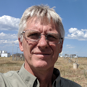
Rob Cifelli
PSL Research Scientist


Chris Cox
PSL Physical Scientist

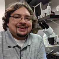
Ryan Currier
PSL Hydrologist


Dan Gottas
PSL Research Meteorologist


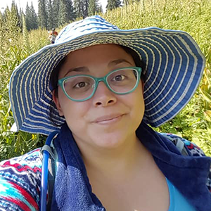
Mimi Abel
PSL Research Scientist

Janet Intrieri
PSL Research Scientist


Kelly Mahoney
PSL Research Scientist
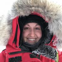
Sara Morris
PSL Research Scientist
Jackson Osborn
PSL Engineer

Jonah Sandoval
PSL Engineer


Allen White
PSL Research Meteorologist
Technology
Take a peek at details about some of the observing technologies being used.

PSL and CIRES designed and built the ASFS to be a moveable instrument system able to power and maintain itself for an extended period of time. It collects atmospheric data that measures all components of the surface energy budget – the exchange of energy between land and atmosphere. By analyzing these measurements, researchers can gain insight into both local and regional weather and climate systems. Learn more

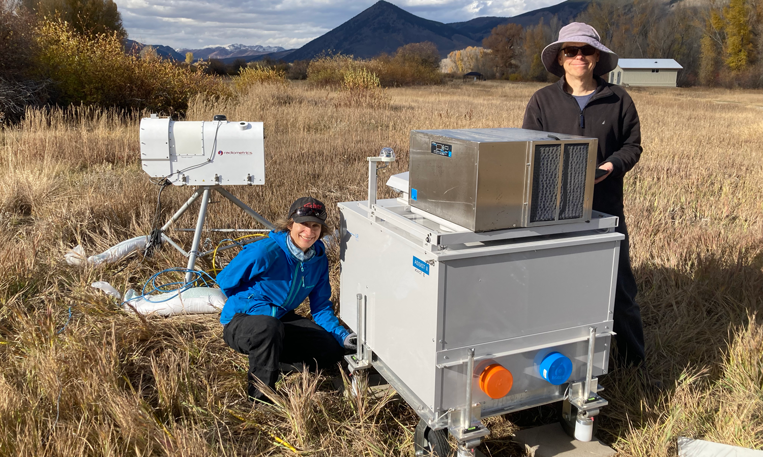
PSL and CIRES are installing an ASSIST-II, which is a self-calibrating infrared emission spectroradiometer that allows remote operation, and is used to monitor atmospheric phenomena. It produces high-accuracy atmospheric profiles of various components, such as temperature, moisture, Ozone, Carbon Dioxide, Nitrous Oxide, and more.

GML, PSL and CIRES are installing ceilometers at Kettle Ponds and Roaring Judy, which are active sensor lidars that emit an eye-safe laser pulse and measure the laser signal as it scatters off aerosols and clouds across the troposphere. These ”backscatter” measurements are analyzed to identify cloud fraction and cloud base heights, and to estimate the planetary boundary layer height.

NSSL is installing the CLAMPS trailer, which is home to three main instruments: a Doppler lidar that sticks out of the roof, a microwave radiometer that pokes out through the side, and an atmospheric emitted radiance interferometer (AERI) that pushes out through the back. The Doppler lidar uses a non-visible laser to measure horizontal and vertical wind speed at high resolution in the lowest parts of the atmosphere. The AERI and microwave radiometer are both passive sensors, meaning they only “listen” for signals. Both instruments measure downwelling radiance from the atmosphere, which is used to retrieve high resolution profiles of temperature and moisture. CLAMPS also has a surface meteorology station to measure the weather conditions right at the surface.


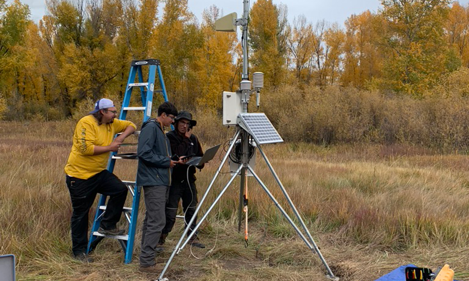
ARL is installing a 10-meter (33-foot) micrometeorological tower and 3-meter tripod tower at the Kettle Ponds field site. The 10-meter tower is equipped at three levels with instruments that measure wind speed and direction and air temperature. A system at the top of the tower provides observations of turbulence, and the exchange of both heat (or energy) and carbon between the land and atmosphere. One arm has sensors that measure incoming and outgoing long and shortwave and visible radiation, as well as sensors that observe surface temperature. Ground instruments include probes that can detect soil moisture and temperature at various depths between 2-50 cm. The tripod tower has instruments that observe the same variables as the 10-m tower. The tripod is also equipped with sensors to measure snow temperature and density every 10 cm.


PSL and CIRES are installing two Snow Level Radars, which are vertically pointing radars that transmit a continuous beam of energy and receive backscattered energy from clouds, precipitation, and atmospheric turbulence. The returned signals from precipitation are used to estimate the level in the atmosphere where snow melts and becomes rain, aka, the snow level.

GML and CIRES are installing two surface radiation systems to measure the exchange of radiative energy between the atmosphere and the land. These systems consist of several radiometers that passively observe radiation emitted and/or reflected from the atmosphere and the land surface. The radiometers measure radiation at different wavelengths from different directions. Scientists analyze these measurements and derive information on sun, cloud, and surface conditions.

HELiX: PSL and CIRES will operate this this rotary-wing aircraft equipped with stabilized up- and downward looking pyranometers. These sensors measure the incident solar energy and when used together they can provide information on the reflectivity of the surface. The downward looking gimbal also includes a multispectral camera that can be used to document snow cover, dust on snow events, and soil and plant properties.

RAAVEN: CIRES/PSL and CU IRISS will operate this fixed-wing aircraft equipped with the NOAA PSL miniFlux instrumentation. It is set up to measure temperature, pressure, humidity, winds, turbulence and surface/sky temperatures. It can fly for up to two hours at a time and will provide profiles that are assimilated into experimental high-resolution models that target micro- and meso-scale phenomena.

S2: This fixed-wing aircraft is equipped with an L-band radiometer to make measurements of soil moisture. It also carries meteorological sensors and a multispectral camera to document thermodynamic state and winds as well as image the surface and evaluate plant health. It will be operated by Black Swift Technologies, conducting flight patterns prescribed by CIRES/PSL.

PSL and CIRA have installed an X-band scanning radar, which detects both liquid and solid precipitation in the atmosphere. During SPLASH, it will be used to determine the type of precipitation – such as raindrops, snow, and graupel – as well as the amount that is falling in a region around the radar. Since there will be a complementary X-band deployed as part of SAIL, the observations from the SPLASH and SAIL radars can be combined to identify the wind patterns in the clouds. Both the precipitation and the wind observations will be used to evaluate forecasts from NOAA’s High Resolution Rapid Refresh model.
Photo Gallery
October 2021
Bianca Adler and Jim Wilczak install a MWR and ASSIST at Roaring Judy.
September 2021
Jackson Osborn, Jonah Sandoval, Dave Costa finishing setup of a surface met tower.
September 2021
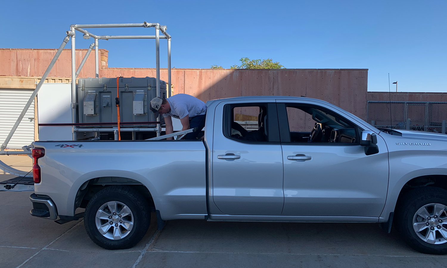
Strapping down an ASFS for transport.
September 2021
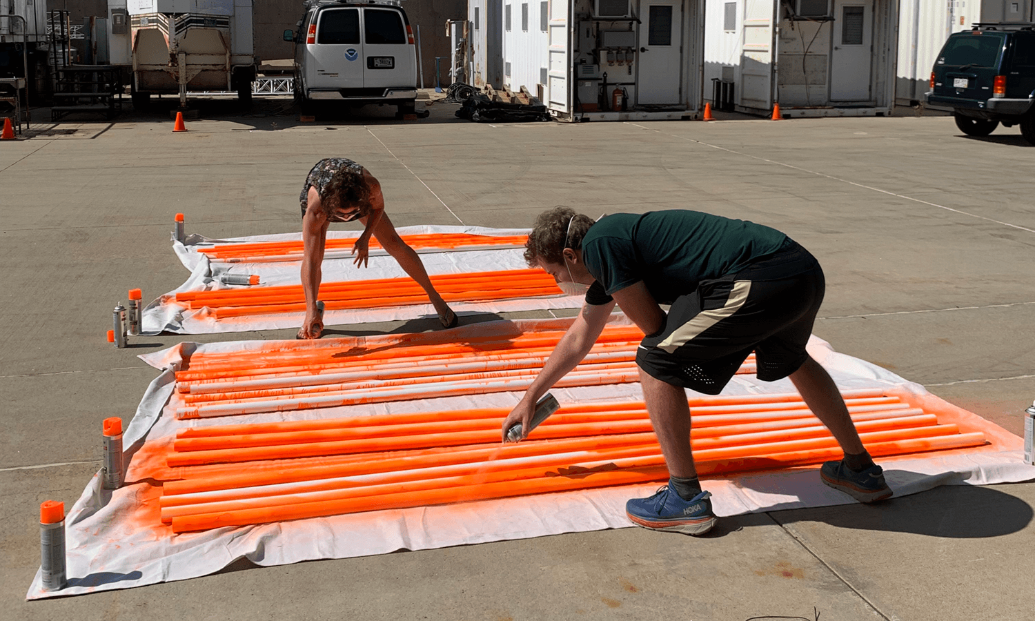
Prepping snow poles by painting them a highly visible color.
March 2021
Site Survey of Brush Creek area.
March 2021
Site Survey of Kettle Ponds area with existing equipment.
March 2021
Site Survey of Roaring Judy area.
March 2021
Site Survey of Avery Peak picnic ground area.
Background
Motivation
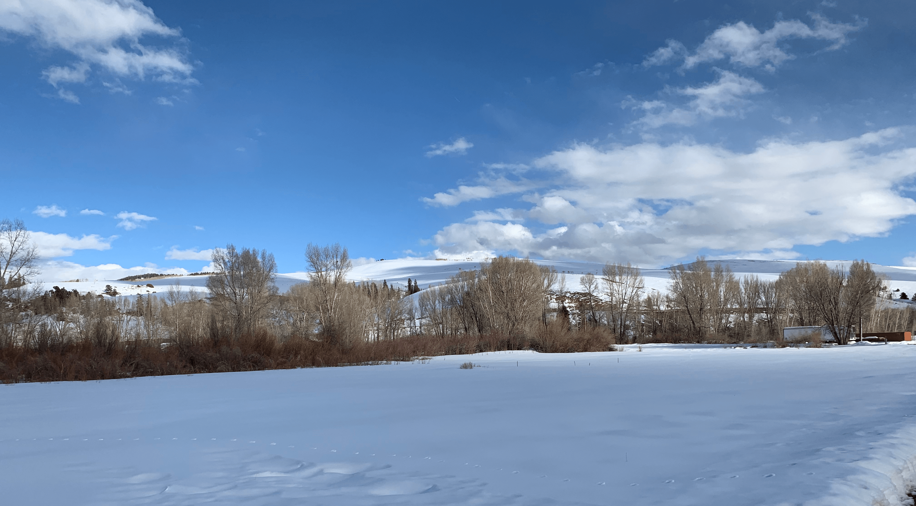
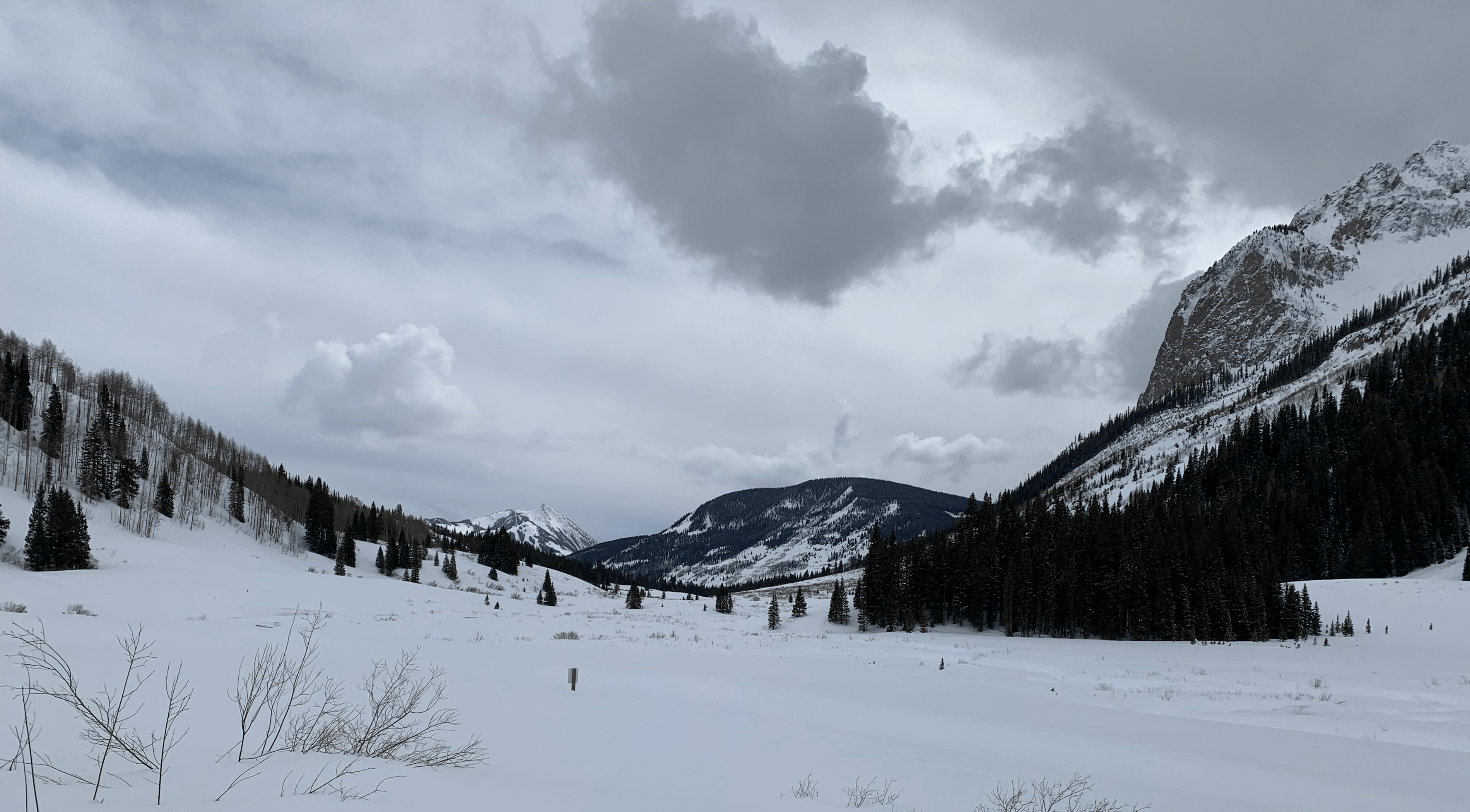
The Colorado River Basin, a primary source of water for much of the southwestern United States, is estimated to see reductions in runoff ranging between 10% to nearly 50% by mid-century. Persistent dry conditions over the basin combined with warming, have resulted in uncertainty about long-term reliability of the Colorado River Basin as a crucial water source. These stresses, along with growing regional population, enhance the need for careful water resource management, elevating the importance of reliable prediction of river flow and its drivers mirroring important decision making that is required for many river basins across the western United States. Improved observing in the East River watershed supports advanced understanding of processes critical to weather forecasting and water management, and other societally-relevant topics.
Approach
Snowmelt in mountainous headwater regions is the primary contributor of annual basin natural streamflow and water reservoir storage. Given this dependence, some central drivers of Colorado River Basin hydrology and the ability to accurately predict this streamflow include near-surface temperature, precipitation amount, soil moisture, and snowpack properties. Measuring, evaluating, and understanding the contributions and relative uncertainties of these meteorological and hydrologic processes is critical to advancing NOAA’s weather and water prediction capabilities. SPLASH will deploy a variety of sensing systems to observe surface–atmosphere exchange processes, remote and surface sensors to improve understanding of clouds and precipitation, and a collection of observing systems to make detailed measurements of the atmospheric boundary layer. Leveraging ongoing NOAA research, development and operations, and in conjunction with concurrent efforts supported by other agencies, including the U.S. Department of Energy SAIL (Surface-Atmosphere Integrated field Laboratory) campaign and Watershed Function Science Focus Area, SPLASH will provide unprecedented perspectives on some of these critical components to support improved prediction of weather and water over complex terrain.
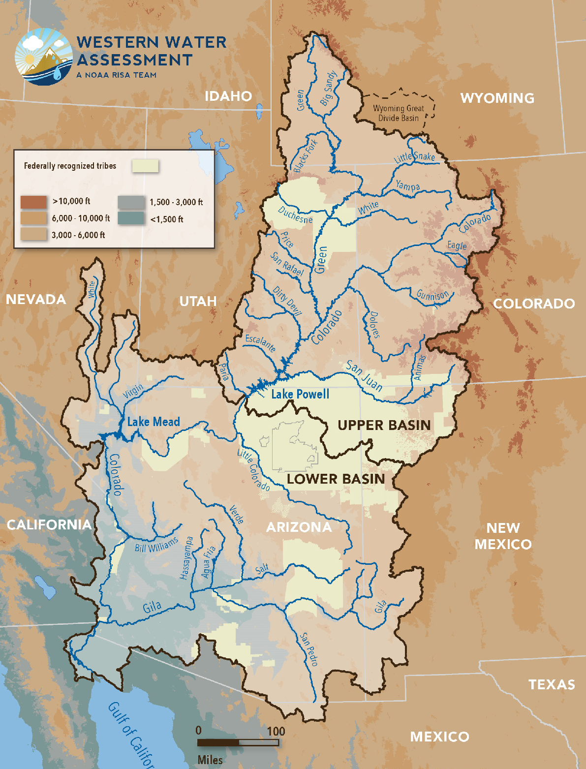
Colorado River Basin
Resources
Documents
Presentations
- SPLASH/SAIL/SOS (S3) Workshop Presentations
- The Study of Precipitation, the Lower-Atmosphere and Surface for Hydrometeorology
Related Links
Publications
- Adler, B., J. Wilczak, L. Bianco, L. Bariteau, C.J. Cox, G. de Boer, I. Djalalova, J.M. Intrieri, T. Meyers, J.B. Olson, S. Pezoa, J. Sedlar, E. Smith, D.D. Turner and A. White,2023: Passive remote sensing of the atmospheric boundary layer in Colorado’s East River Valley during the seasonal change from snow-free to snow-covered ground, Journal of Geophysical Research - Atmospheres, 128, e2023JD038497, https://doi.org/10.1029/2023JD038497.
- de Boer, G., A. White, R. Cifelli, J. Intrieri, M. Hughes, K. Mahoney, T. Meyers, K. Lantz, J. Hamilton, W.R. Currier, J. Sedlar, C. Cox, E. Hulm, L.D. Riihimaki, B. Adler, L. Bianco, A. Morales, J. Wilczak, J. Elston, M. Stachura D. Jackson, S. Morris, V Chandrasekar, S. Biswas, B. Schmatz, F. Junyent, J. Reithel, E. Smith, K. Schloesser, J. Kochendorfer, M. Meyers, M. Gallagher, J. Longenecker, C. Olheiser, J. Bytheway, B. Moore, R. Calmer, M.D. Shupe, B. Butterworth, S. Heflin, R. Palladino, D. Feldman, K. Williams, J. Pinto, J. Osborn, D. Costa, E. Hall, C. Herrerab, G. Hodges, L. Soldo, S. Stierle, and R.S. Webb, 2023: Supporting Advancement in Weather and Water Prediction in the Upper Colorado River Basin: The SPLASH Campaign, Bull. Amer. Meteor. Soc., accepted for publication, https://doi.org/10.1175/BAMS-D-22-0147.1
- Feldman, D.R., A.C. Aiken, W. R. Boos, R. Carroll, V. Chandrasekar, S. Collis, J. Creamean, G. de Boer, J. Deems, P. J. DeMott, J. Fan, A. N. Flores, D. Gochis, M. Grover, T. Hill, A. Hodshire, E. Hulm1, C. Hume, R. Jackson, F. Junyent, A. Kennedy, M. Kumjian, E. Levin, J. D. Lundquist, J. O’Brien, M. S. Raleigh, J. Reithel, A. Rhoades, K. Rittger, W. Rudisill1, Z. Sherman, E. Siirila-Woodburn, S. M. Skiles, J. N. Smith, R. C. Sullivan, A. Theisen, M. Tuftedal, A. C. Varble, A. Wiedlea, S. Wielandt, K. Williams, Z. Xu, 2023: The Surface Atmosphere Integrated Field Laboratory (SAIL) Campaign, Bull. Amer. Meteor. Soc., accepted for publication, https://doi.org/10.1175/BAMS-D-22-0049.1.