ENRR
El Niño Rapid Response Field Campaign
January – March 2016
The major El Niño of 2015-2016 presented an unprecedented scientific opportunity for NOAA to accelerate advances in understanding and predictions of an extreme climate event and its impacts through research conducted while the event was ongoing. NOAA's Physical Sciences Laboratory (PSL) played a central role in the NOAA El Niño Rapid Response (ENRR) field campaign to determine key mechanisms affecting El Niño's impacts on the U.S. and their implications for improving NOAA's observational systems, models and predictions. The ENRR campaign spanned the central and eastern tropical Pacific to California. Multiple types of observing resources collected measurements from the air, ocean, and ground between January and March of 2016. Of particular interest was the increased risk for intense wintertime storms and heavy rainfall affecting the US West Coast during this event's very strong El Niño. Read More
Observations in the Field...

NOAA G-IV Aircraft
This aircraft flew out of Honolulu, Hawaii carrying a suite of meteorological sensors and deploying dropsondes for 22 research flights from mid January to early March 2016.
NOAA Research Ship Ronald H. Brown
The ship launched up to 8-times daily radiosondes on the Tropical Atmosphere Ocean (TAO) survey cruise from February 16 to March 18, 2016 (Honolulu to San Diego).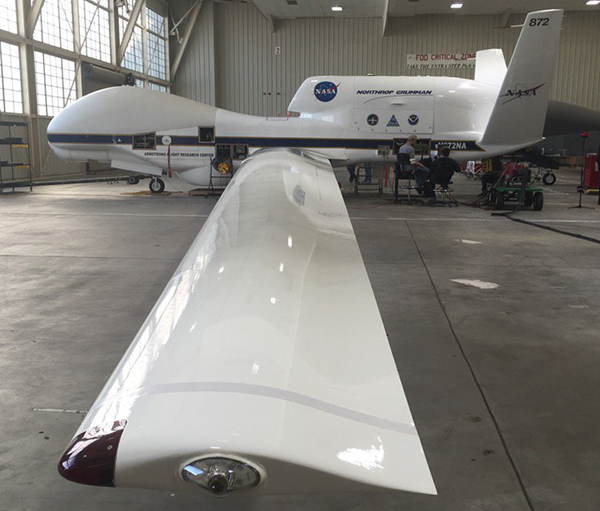
NASA Global Hawk Unmanned Aircraft
The Global Hawk deployed through the SHOUT project led by NOAA's UAS Program, carried a suite of meteorological sensors and launch dropsondes during three research flights in February.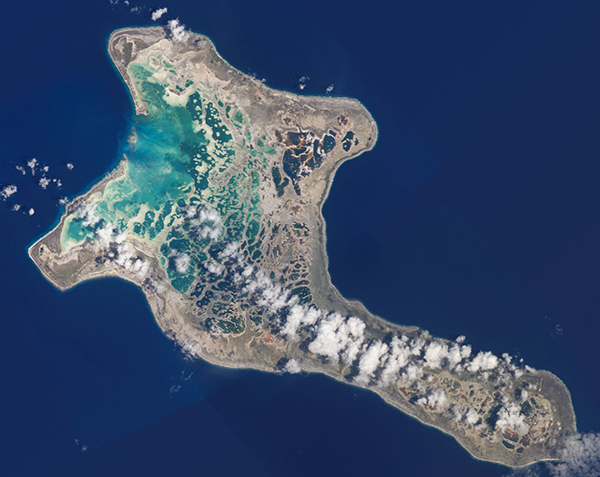
Kiritimati Island Observations
On Kiritimati (Christmas) Island, approximately 1,340 miles south of Honolulu, a radiosonde sounding system was set up with twice-a-day vertical soundings made continuously from late January through March 2016.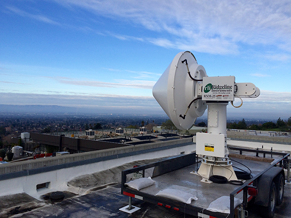
Scanning X-Band Radar in San Francisco
The radar will be deployed to the south San Francisco Bay as an experimental radar system, which will provide the more accurate rainfall estimates for the region that are needed to better manage and mitigate negative impacts. Starting in late January.
Daily Forecast Briefings
PSL researchers in Boulder, Colorado analyzed conditions and held daily forecast briefings, which were used to plan and coordinate field observations.

- More Information
- Handout
- ENRR Conference Poster
- Science Overview
- Implementation Plan
- Mission Partners
- ENRR Blog (Hosted by CIRES)
- ENRR in the News
- Resources
- PSL ENRR Publications
- Forecasting Resources
- Data Portal
- Photo Album (on Flickr)
- Learn More about El Niño
- PSL Leads
- Randall Dole and Ryan Spackman
- Media Contact
- Theo.Stein@noaa.gov