Studying atmosphere–ocean processes in the Southeastern Pacific
The southeastern Pacific Ocean is an important climatic region where interactions between the atmosphere and ocean affect climate around the world. However, present climate models have well-known sea surface temperature biases in regions dominated by stratocumulus clouds. These biases are believed to be partly related to overly simplified representations of cloud and air-sea interaction processes. Better understanding of the effects of persistent stratus cloud coverage on ocean temperatures will help improve climate models and predictions.
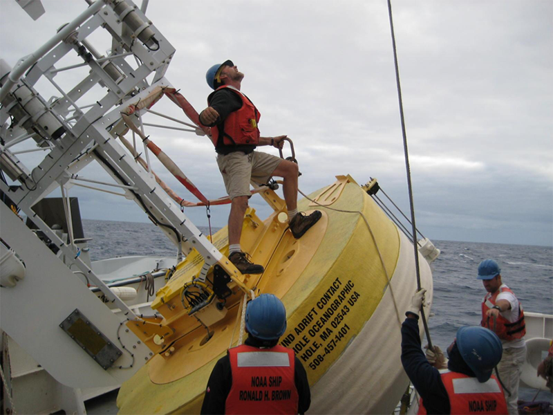
This spring, off the coast of Chile—in the center of the largest marine stratus cloud region on the planet—scientists will participate in the annual Stratus research cruise with the goal of observing and advancing understanding of these processes. To aid in this effort, NOAA has funded a Woods Hole Oceanographic Institution (WHOI) flux reference buoy in the Eastern Tropical Pacific since 2000. Flux reference buoys collect near-surface atmospheric data and profiles of oceanic temperature, salinity, and current. As in past years, ESRL Physical Sciences Laboratory (PSL) researchers will deploy the NOAA Air-Sea Flux system—an instrument package that measures the exchange (or flux) of heat, water, and momentum between the atmosphere and the ocean. In addition, the researchers will test a new stripped down, fully automated, easier-to-install version of the flux system, called the PSL AutoFlux (PAF), and compare those results to the original system.
Deployments of the flux system typically include daily transmission of field-processed data summaries via the ship’s satellite internet system back to PSL, where they appear on a public ftp site. Because ship internet links may be unreliable or at times unavailable, the PAF is equipped with an IRIDIUM satellite link, which allows transmission of data independent of the ship’s system. The plan is for the PAF to operate unattended for the entire Stratus cruise, since system performance can be monitored via the data summaries sent to PSL. In the future, the PAF will be used primarily for buoy or research vessel calibration missions where the full flux system is not required and cost and mission efficiency considerations outweigh the added value of the more direct observations provided by the full flux system.
The Stratus research cruise represents a collaboration between groups within and external to NOAA. NOAA’s Pacific Marine Environmental Laboratory (PMEL) has been involved in Stratus since 2001 as a scientific collaborator on observations and observation technology. WHOI’s Upper Ocean Processes Group operates the Stratus buoy and has also installed meteorological sensors on a PMEL tsunami buoy in the region.
The 2017 mission takes place aboard the NOAA ship Ronald H. Brown beginning May 5 in Rodman, Panama and ending in Arica, Chile on May 20. Instruments will be installed approximately one week prior to launch in Charleston, South Carolina.
Posted: April 27, 2017
- Related Information
- NOAA's Air-Sea Flux System
- NOAA/PMEL Stratus Mooring
- WHOI Stratus Project page