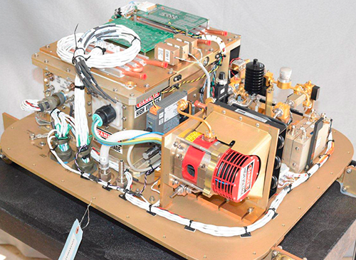
W-Band Radar
NOAA and CIRES researchers from the Physical Sciences Laboratory designed and built a highly sensitive radar, called the W-Band Radar, which is used to detect small water droplets. The term W-Band refers to the frequency band in which the radar operates, 95 GHz. This type of radar is also termed a millimeter–wavelength radar because the wavelength of the electromagnetic energy that is used to detect droplets is about 3 millimeters. This small wavelength allows the radar to "see" very small objects, such as spherical water droplets. Weather radars that most people see on their local weather channel use longer wavelengths, typically 10 cm, and can detect only large precipitation drops in rain clouds. The W-Band radars can provide sensitive measurements in clouds that contain very small water droplets of fog or mist.
The W-Band radar has been used on research ships to look up at the clouds that develop over the ocean on several programs that study the energy flux near the ocean surface. Since its development, the W-Band has successfully collected data for numerous experiments aboard reseach ships in the South Pacific, the North Pacific, and the Indian Ocean.
In 2013, the radar was deconstructed and repackaged for use on research aircraft to study how sea-spray might impact the path and strength of hurricanes. Housed in the belly of the aircraft, the radar looks down through a thick radar-transparent window at the sea surface below.
Learn More